Professional Drone Services in Kent
Accurate, Safe & Cost-Effective Aerial Solutions for Railway, Construction, and Infrastructure Projects
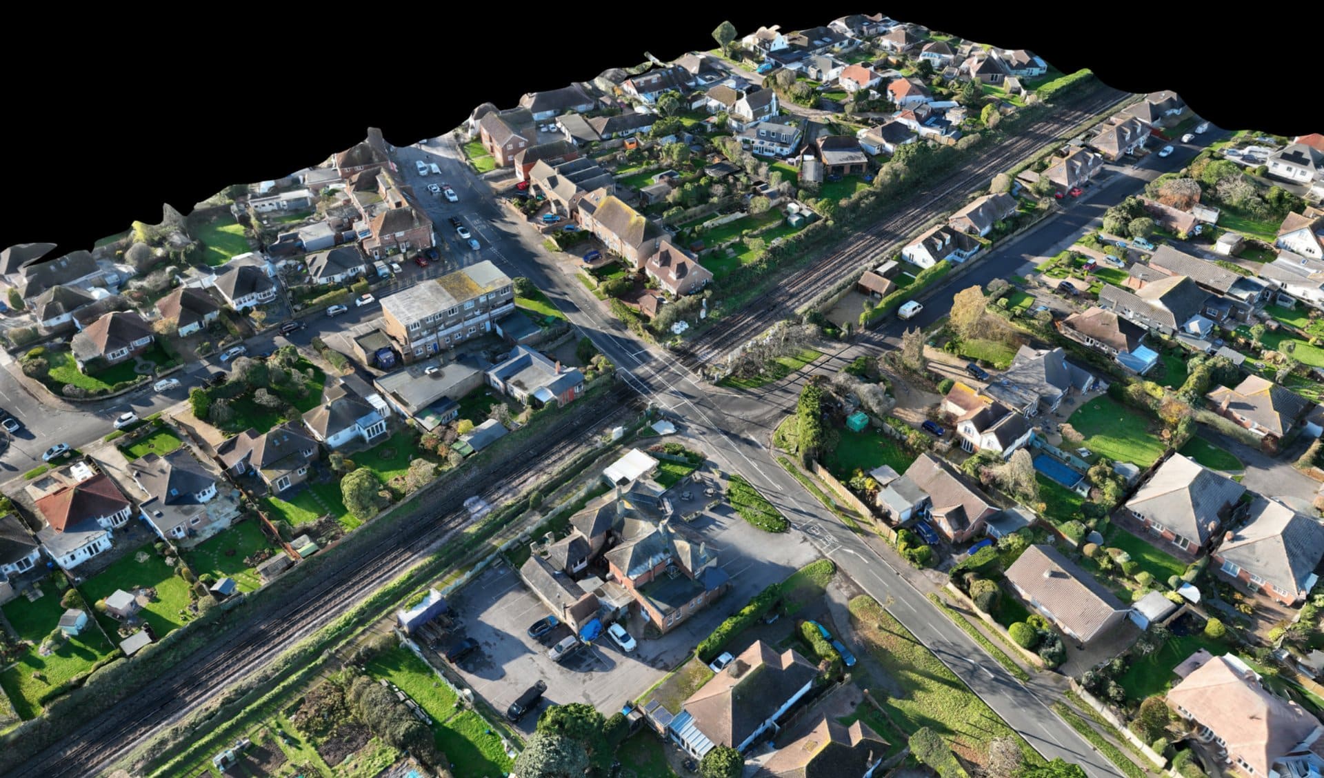
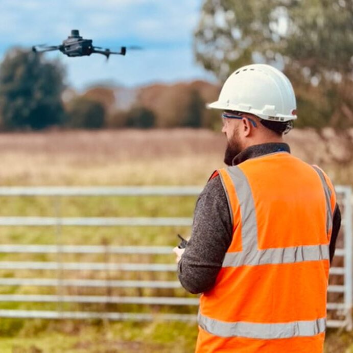
PixAir Drone Solutions provides high-quality drone services across Kent and the South East, specialising in aerial surveys, 3D mapping, inspections, and reality capture. Our work supports rail, construction, and infrastructure projects with efficient, CAA-approved data solutions that reduce boots on ballast and improve project insight.
Drone Survey & Mapping
High-precision topographic surveys and terrain models tailored for CAD and GIS use. Ideal for remote or hazardous sites across Kent.
Construction Site Inspections
Aerial photography and 360° imagery for progress tracking, safety audits, and planning — all with minimal site disruption.
Railway Inspections
Specialist in line-of-route surveys and signal sighting support. Reduce boots on ballast while capturing vital data safely.
Reality Capture & Walkthroughs
Ground and aerial 360° photography and video to create site walkthroughs. Perfect for remote project collaboration.
Scheme Plan Verification
Use drone imagery to verify cable routes, component positions, and clearances, validated by qualified 3B/4 signal testers.
CAD/GIS-Ready Outputs
Deliverables in formats like GeoTIFF, DXF, OBJ, and LAS – all ready for engineering workflows.
Why Choose PixAir Drone Solutions?
At PixAir, we combine expert knowledge in railway signalling and construction with advanced drone capabilities to deliver accurate, high-resolution aerial data. Our operations are CAA-approved and fully insured, meaning every job is conducted with full regulatory compliance and safety assurance.
Whether it’s mapping a railway corridor, inspecting a construction site, or supporting infrastructure planning, our drone services eliminate the need for boots on ballast and reduce disruption to live environments. We use RTK and enterprise technology to ensure survey-grade accuracy in every deliverable.
Our process
Need Drone Services in Kent?
Get in touch today for a quote or a walkthrough of recent projects.