About PixAir Drone Solutions
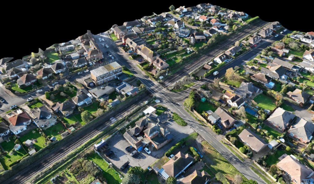
At PixAir Drone Solutions, we specialise in professional aerial surveys, inspections and high‑precision mapping for railway and construction projects across Kent and the South East. As a Civil Aviation Authority (CAA) approved and fully insured operator, we provide reliable and safe drone services that deliver accurate data and clear insights.
Why Choose Us
- CAA authorised & insured – safety and compliance come first. Our pilots operate within CAA regulations and carry appropriate insurance.
- Specialist expertise – we focus on railway and construction sites, so we understand the risks and logistics of working on busy infrastructure.
- High-precision mapping & 3D modelling – we use advanced photogrammetry and LiDAR to produce detailed terrain models, orthomosaics and 3D point clouds.
- Local knowledge – based in Kent, we serve clients throughout the South East with a rapid response and excellent local knowledge.
- Customer-focused – we take the time to understand your project and deliver data in formats that suit your workflow.
Our Services
Our services include high‑resolution land surveys, accurate stockpile analysis and detailed terrain modelling for smarter site planning and monitoring, progress monitoring, structural checks and site documentation made safe and efficient, trackside inspections, asset monitoring and infrastructure surveys that reduce boots on ballast and improve site safety, and aerial and ground‑based 360° data to create digital twins and site walkthroughs for remote teams.